
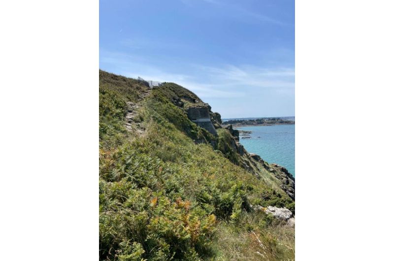
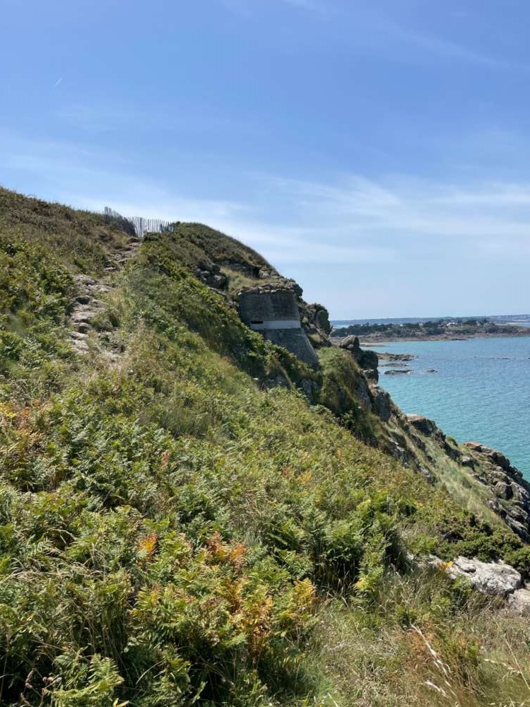
Pointe de La Garde Guérin

La pointe de la garde guérin culmine à 48 m, axée vers le nord elle fut l'objet d'une étude approfondie de la part de l'occupant Allemand. La festung Saint-Malo s'appuie vers l'ouest sur la rivière du Frémur. De nombreuses fortifications sont implantées sur le front de mer, dans la région de St.Briac et de Lancieux, fortifications qui se poursuivent vers la cité malouine.
Cependant, les Allemands vont réaliser sur la pointe de La Garde-Guérin un important complexe souterrain, car elle a des vues très étendues sur le large, du fort de La Varde à l'est jusqu'au cap Fréhel à l'ouest, et permets de couvrir le flanc ouest de la Festung et de battre l'étendue marine en coordination avec Cézembre. De conception différente des ouvrages défensifs côtiers, Ra145 Paulus (nom de code de l'ouvrage) offre un réseau de galeries d'une longueur approximative de 400 mètres. La base de cette pointe rocheuse est particulière de l'Atlantikwall. L'accès aux galeries se fait par un gros bunker copié semble-t'il sur les ouvrages de la ligne Maginot, de type SK, abritant un bloc R634 à cloche blindée destiné à battre le terrain en protection de l'ouvrage, d'un abri-garage pour pièce Pak de 7,5 cm et d'un tobrouk en toiture.
L'ensemble est ouvert sur deux côtés, permettant la circulation de véhicules, et protégé par deux caponnières. On trouve également 2 casemates d'artillerie R611 mod, un bloc pour 47 mm Skoda, un projecteur, un abri R501,une citerne, un observatoire d'artillerie R120a. Belle promenade en perspective. Le sud de la pointe est barré par un fossé antichars.
Crédit photo David Schenkel
